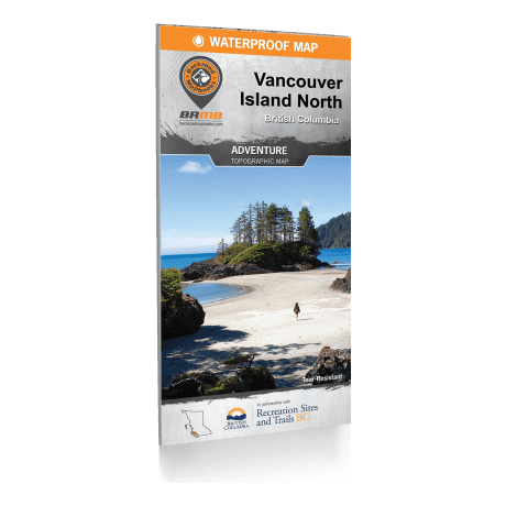
Backroad Mapbooks - Vancouver Island North Recreation Map 2nd Edition
Article # C: 316025 B: 3387105
Share:
Product Description
• Over 45,000 kilometres of roads including highways, county, city roads and logging, and industry backroads
• Over 2,500 kilometres of Multi-use Trails for hikers, mountain bikers, horseback riders, cross-country skiers and more
• Over 1,800 kilometres of ATV/Motorized Trails
• Close to 100 kilometres of Snowmobile Trails
• Almost 5,000 kilometres of Paddling and Kayak Routes
• 67 stocked Fishing lakes + 196 native species Fishing lakes
This recreation map for Vancouver Island North highlights all the recreation sites, campgrounds, paddling routes for canoers and kayakers, fishing lakes and rivers, logging and resource roads, hiking and mountain biking trails, snowshoe and cross-country ski areas, motorized trails for dirt bikers, ATVers and snowmobiling, wildlife viewing areas and more. This map bundle includes two 1:180,000 scale maps, each covering 25,560 km2 (9,870 mi2) or 153 x 167 km (95 x 104 mi), plus an inset map of the Sayward Forest Canoe Route and Cape Scott Island. No other map provides you with this much recreational and topographic detail for northern Vancouver Island. Special features include labelled trailhead location, fish species and stocking information, labelled Wildlife Management Units for hunters and countless recreational Points of Interest.
Vancouver Island North Map Features:
• Easy to read, large-scale 34” x 65.25” map derived from our Backroad Mapbooks at 1:20,000 scale
• Inset Map of Sayward Forest Paddling Circuit
• Featured content for provincial park and BC recreation sites, attractions, trails, and more including
o Broughton Archipelago, Cape Scott, Catala – Nucatlitz, Elk Falls, Miracle Beach, Raft, Strathcona Park and more
• The map shows areas features such as First Nations, Private and Leased Land and more
• Topographic maps with detailed shaded relief
• Featured Regional Cities include
o Alert Bay, Brooks Peninsula Provincial Park, Campbell River, Cape Scott, Coal Harbour, Comox, Courtenay, Cumberland, Gold River, Holberg, Kyuquot, Nootka Island, Port Alice, Port Hardy, Port McNeill, Powell River, Quadra Island, Sayward, Strathcona Provincial Park, Tahsis, Telegraph Cove, Woss, Zeballos and more!
• The most complete recreation, industry and county road coverage available for northern Vancouver Island
• Find your location using Map referencing grids by UTM or Latitude and Longitude
• Geographic Land and Water features
• and much more!
