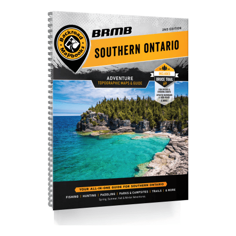
Backroad Mapbooks - Southern Ontario 2nd Edition
Article # C: 298097 B: 3387108
Share:
Product Description
• 65 maps @ 1:150,000-155,000 scale
• The most complete road coverage for Southern Ontario, from highways and rural roads to bush roads and logging roads
• Countless trails for hiking, mountain biking, horseback riding, cross-country skiing, snowmobiling, ATVing and snowshoeing
• Clearly defined Wildlife Management Units for hunting
• Paddling routes and portages for canoers and kayakers
• Thousands of Adventure POIs including campsites, viewpoints, waterfalls and boat launches
• Addition of Crown land, County Forest Tracts and private land
• Labelled sportfish species on the maps
• Fish stocking charts for brook trout, brown trout, lake trout, rainbow trout, splake and walleye
• Trail charts for the Bruce Trail and Trans Canada Trail
• Tons of new motorized and multi-use trails
• Refined and updated Adventure listings
• And much more!
Surrounded by three of the five Great Lakes – Lake Erie, Lake Huron and Lake Ontario – this region of Ontario is home to the scenic Niagara Escarpment which winds north-south from Niagara Falls to Tobermory, plenty of forest and farmland as well as the tourism centres of the Greater Toronto Area and Niagara Falls. The area covered in this mapbook offers plenty of outdoor recreation activities and adventure opportunities. Whether you are looking to hike, camp, fish, hunt, ATV, snowmobile, mountain bike, paddle or just see the sights, the 2nd edition of our Southern Ontario Backroad Mapbook is your ultimate guide to exploring the area.
Backroad Mapbooks are the industry leader in cartographic sophistication, making these the maps of choice for everyone from outdoor recreationists to industry workers and Search and Rescue teams. Also included in the Mapbook are hundreds of detailed Adventure listings, an easy-to-use index divided into Map and Adventure sections, an advertiser’s list, important numbers and more. With thousands of adventures to try including hiking, camping, fishing, snowmobiling and wildlife viewing, your only problem will be deciding where to explore first.
Backroad Mapbook Southern Ontario 2nd Edition Features:
• Over 40 Backroad Attractions
• Over 120 River and 140 Lake fishing hotspots
• 30+ River and Lake paddling routes for canoers and kayakers
• Close to 60 National and Provincial Parks
• 200+ Conservation Areas and Regional Parks
• 330+ Multi-Use Trails
• 40+ ATV/OHV areas
• 70 Snowmobiling routes
• 45+ Wildlife Viewing areas
• 80+ Winter Recreation areas


