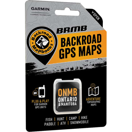
Backroad Mapbooks Ontario & Manitoba - Backroad GPS Maps
Article # C: 347802 B: 3614936
Share:
Product Description
• WRITTEN DESCRIPTIONS - Unique to BRMB's GPS Maps are written Adventure descriptions compiled by our team of outdoor writers and researchers. Descriptions fill you in on information including trail distance and elevation gain, fish species and stocking information, directions to staging areas for ATV and snowmobile, amenities and activities for national and provincial parks, campground size and reservation information, difficulty of paddling routes, game hunting species and much more.
• HUNTING & FISHING - Includes marked Marked Game Hunting Areas and Wildlife Management Zones for hunters and Lake bathymetry (depth contours) for many of the region's fishing lakes
• ROAD CLASSIFICATION - Unique to the Backroad GPS Maps are our enhanced road classifications that help you distinguish the highways from the forest roads and the main roads from the side roads. This extra level of road classification, along with routing ability, helps you to know which roads can be driven in a car and which ones should be left to a four-wheel drive vehicle or ATV. In addition, we offer more recreational points and symbols than any other map source. From RV accessible to backcountry campsites, hiking to snowmobiling trailheads, fishing to paddling access points, we have your adventure covered.
• TRAILS & ROUTES - Includes over 21,500 km of Trails for hikers, mountain bikers, horseback riders, cross-country skiers, including the Trans Canada Trail, 55,000 km of snowmobile trails, 20,000 km of ATV trails and over 36,000 km of paddling routes for canoers and kayakers
• COMPATIBILITY - Compatible with Garmin GPS and Garmin Basecamp, BRMB's Ontario & Manitoba GPS Maps come in Micro SD format and are easy to install and use, bringing the height of cartographic sophistication and outdoor recreation information directly to your GPS device or computer.
Covering a combined area of over 1,700,000 km², Ontario and Manitoba have no shortage of backcountry to explore. From the rolling prairie, sprawling pine forest, and ancient Canadian Shield rock Manitoba to the sparkling shorelines of Ontario's Great Lakes and the vast expanses of wilderness that cover the north, this region of Canada is an incredible destination for outdoor recreation. Whether you are paddling a remote river system, camping under the stars in a provincial park or exploring abandoned roads on your ATV, our Ontario & Manitoba GPS Maps are your ultimate guide to navigating the area.
These Garmin-licensed GPS Maps feature easy-to-read elevation contours and reveal all the natural features such as creeks, wetlands and ponds, plus every road and trail that is left off of other maps. Ten categories of Adventure Points of Interest guide you to the best outdoor recreation sites Ontario and Manitoba have to offer, from easy day hiking to backcountry hunting, fishing, snowmobiling and much more.
From the epic fishing holes of Manitoba's Interlake region to the scenic canoe routes of Ontario's Cottage Country and beyond, Backroad Mapbooks' GPS Maps provide an unmatched level of detail and adventure information.
